PlaneTrackr
A free software simulating an ATC Radarscreen using ADSB Data.
Welcome to PlaneTrackr!
Find the download here:
Background
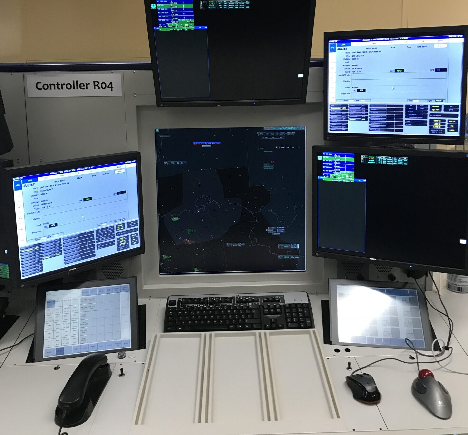
I am somewhat interested in aviation and, like many others, often found myself using FlightRadar24 or similar apps to see what is going on in the skies above. A couple years ago, I was able to visit an ATC ACC facility and take a look at the workplace of an air traffic controller. While that job might not be for me, I found the software they use rather impressive.
Couple years later, while attending university, one class had a task to calculate an aircraft positions from raw radar data to reconstruct a flight. After finishing that task, I was curious on how a reversed calculation would look when using real ADSB data. This is when work on the project that would become FlightTrackr started.
Software
PlaneTrackr is currently WIP and many new features are being implemented. Currently, these features are implemented:
- Automatic download of online ADSB data from OpenSky Network or Airplanes.live.
- Automatic import of local ADSB data from Receivers running TAR1090.
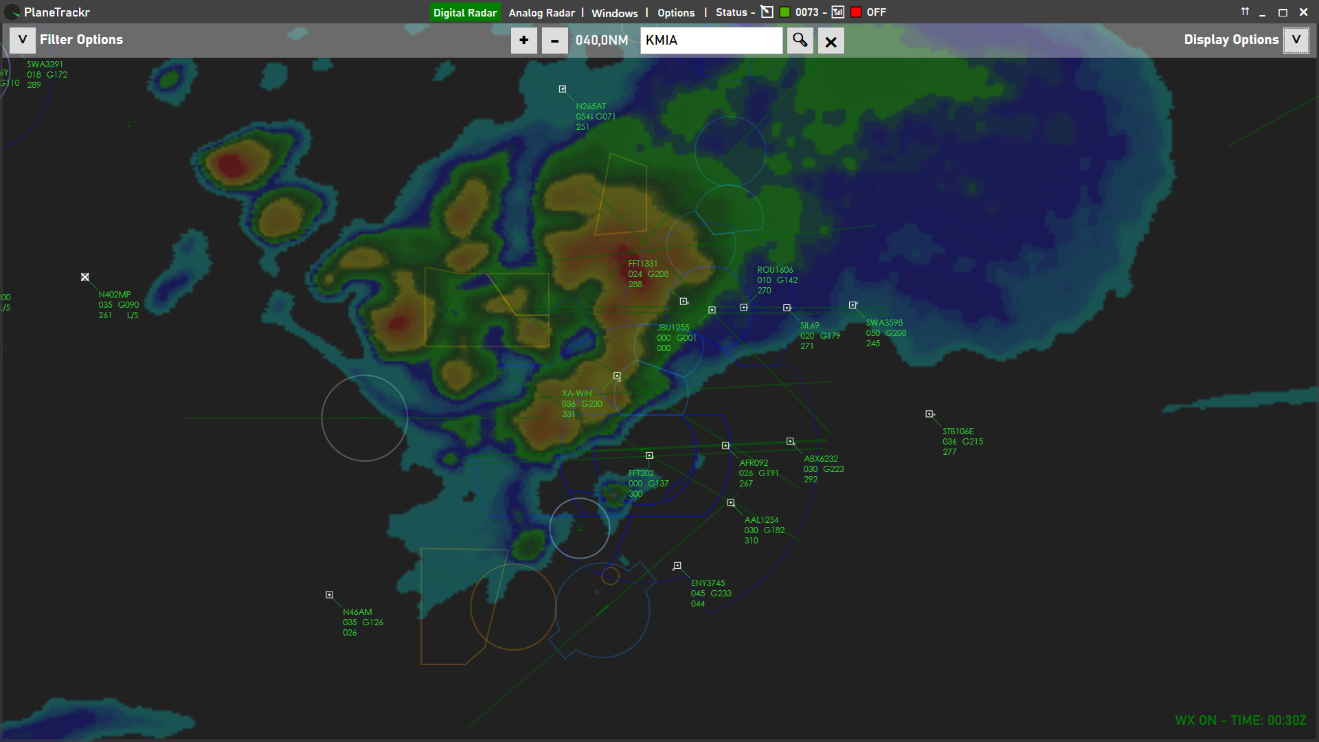
- Analog Radar Scope – A classic radar image, with some options to make it look even more old school.
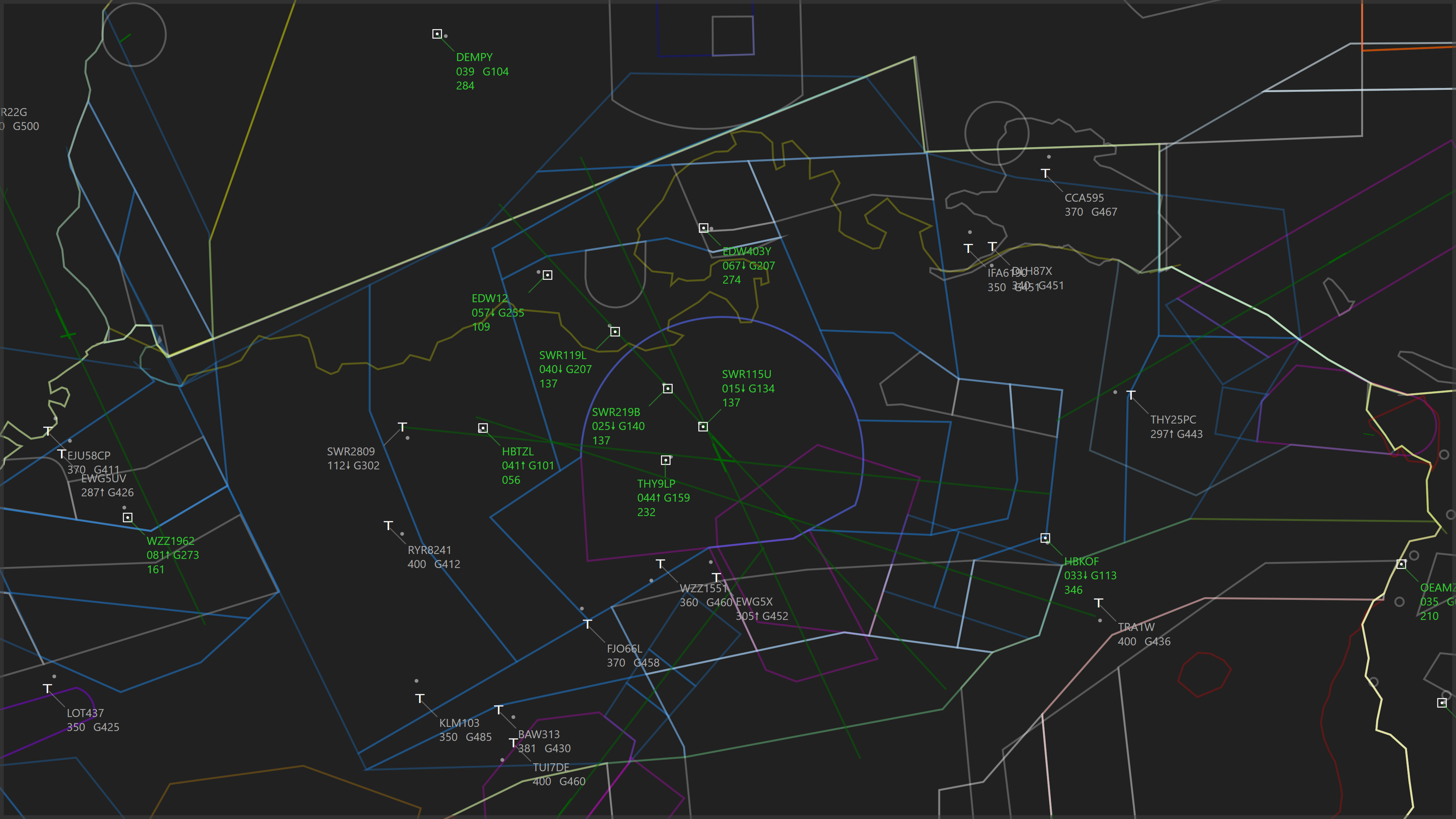
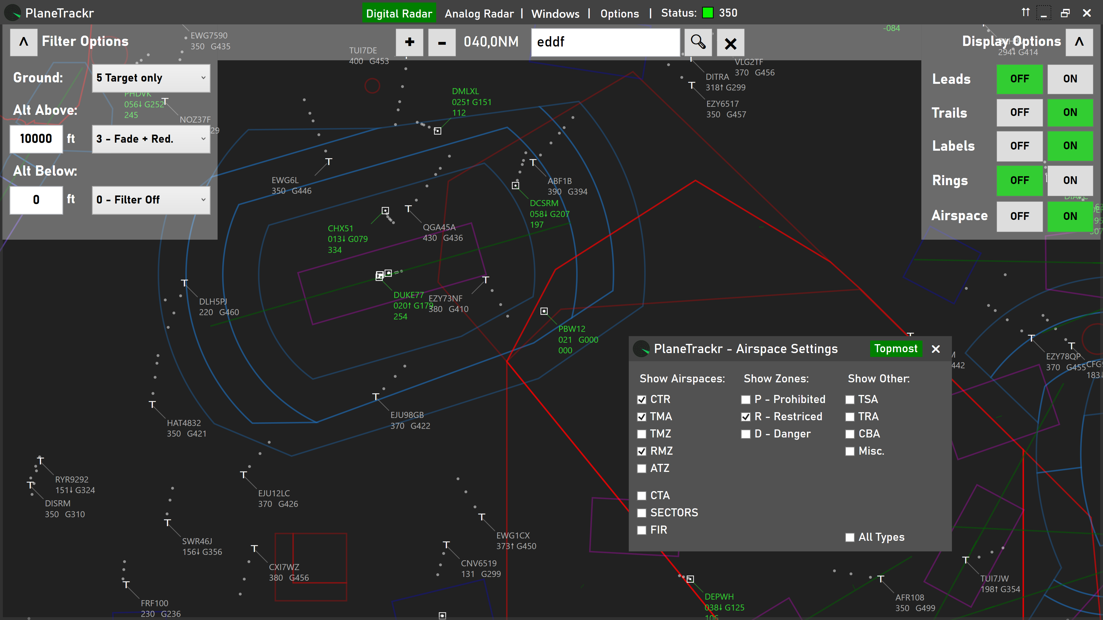
- Digital Radar View – A modern radar screen, heavily inspired by current ATC systems.
- Airspaces – Airspaces are displayed optionally.
- Customizable Radar Filters – Adjustable filters, to just show traffic within defined parameters.
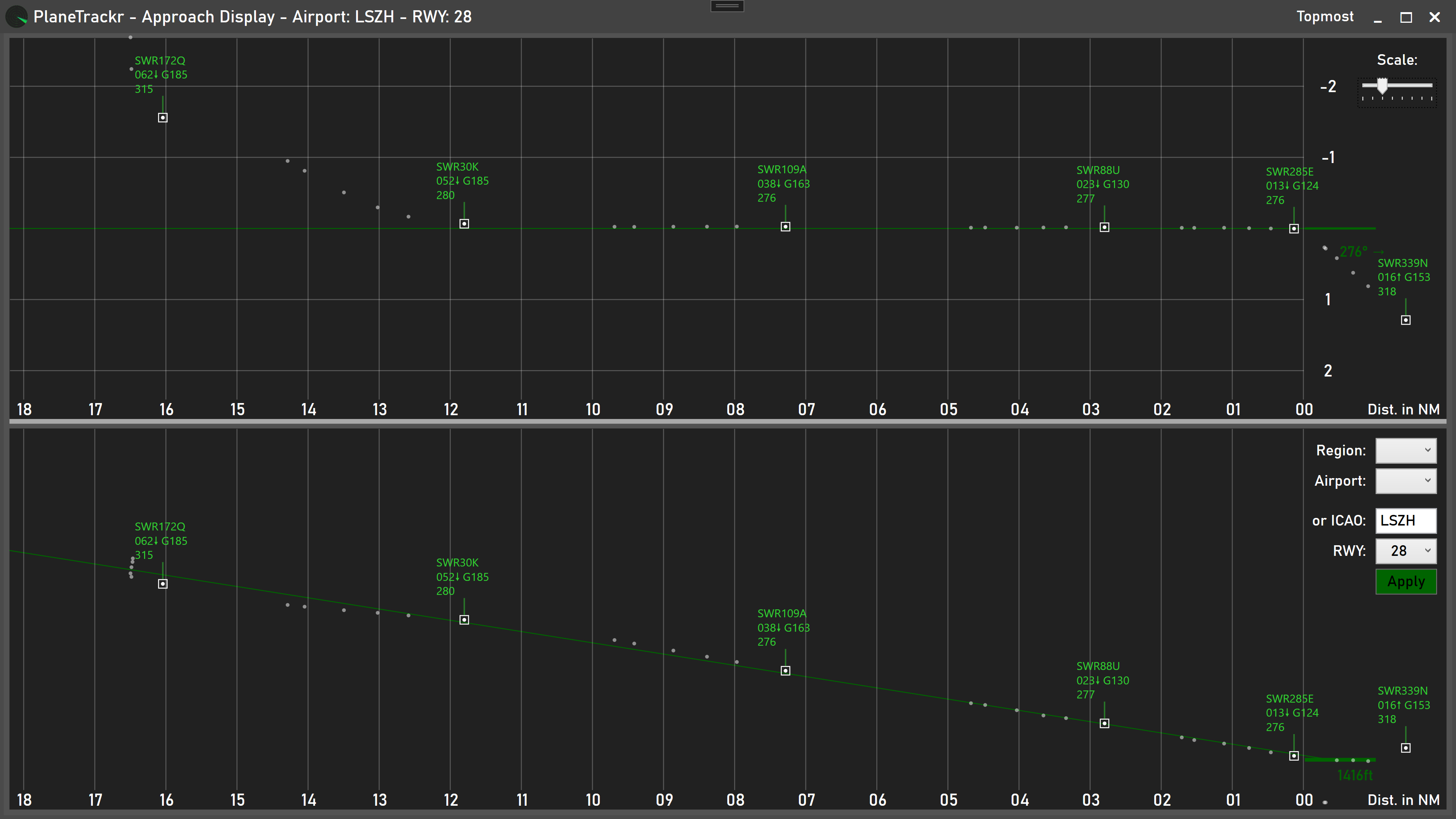
- Approach View – Shows the horizontal and vertical approach path for any runway.
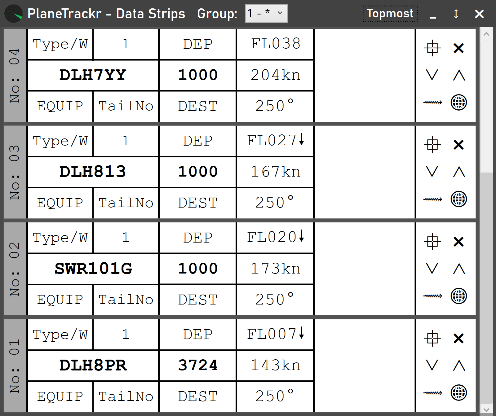
- Flight Data Strips – Intended to mimic the paper strips used by ATC.
- Show flight on OpenSky, FlightRadar24 or Airplanes.live with a single click.
- Many more…
Feature Milestones
Some of the current and feature development goals:
Display Data from a local ADSB Receiver– Implemented 23.05.2022Get more flight information (Departure, Destination,…)– Implemented 22.05.2022Implement ADSBExchange API and use the expanded Data available– Implemented 22.05.2022- Add Navaids, Airways and Departure and Arrival Procedures to the Digital Radar
- Improved design of the Analog Scope
Images

Data Providers
PlaneTrackr gratefully uses data provided by different community efforts and public service providers:
ADS-B data:
> airplanes.live (Primary Source)
Aircraft and Route data:
> HEXDB.IO

> Mictronics

Airspace Data:
> OpenAIP

Airport Data:
> airportdb.io
Weathe Data:
> Rainviewer (weather overlay)