PlaneTrackr – Help – Transition Level & Altitude
A free software simulating an ATC Radarscreen using ADSB Data.
General
The Transition Level and Transition Altitude are relevant for the altimeters of aircraft and their settings. Please refere to Skybrary for a detailed explanation!
Implementation
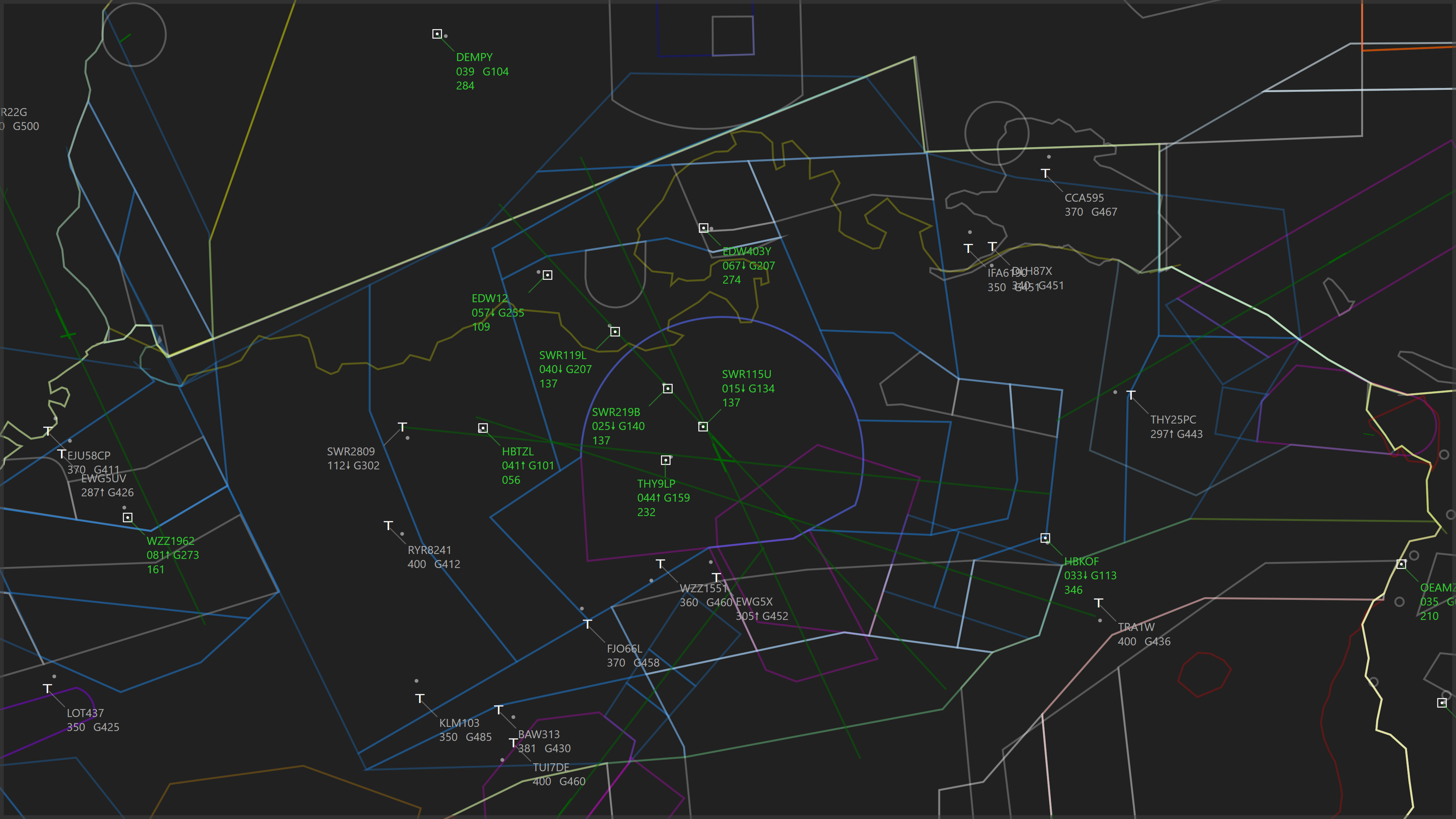
The Transition Level and Altitude have been implemented similar to how they would be shown on an ATC radar.
Targets above the Transition Level will show their altitude in refrence to standard pressure (1013.25hPa or 29.92inHg), while targets below the Transition Altitude will show their altitude in refrence to the QNH, which varies depending on metrological conditions.
This is shown by a F-prexfix (standard pressure) or an A-prefix (QNH pressure) on the Target’s Data Block Altitude respectivly.
Targets inside the Transition Layer (the altitude band between Transition Altitude and Transition Level) will show the F-prefix for climbing or aircraft flying level, and the A-prefix for descending aircraft. This is a limitation of the current implemtation in PlaneTrackr.1
1Note: IFR aircraft should not fly level inside the Transition Layer, and ATC will usually not assign such altitudes or levels. Therefore this ambiguity is only relevant for VFR aircraft that happen to be inside the Transition Layer!
Usage
- European/Asian Airports
- Find the current QNH for your desired airport. This can be found in the METAR or ATIS.
- Find the Transition Altitude. This is fixed for an airport (or several airports inside a region) and can be found in the airport charts (often abriviated as Trans. Alt.)
- Find the Transition Level. This is variable and depends on the current metrological conditions. Transition Level is usually broadcasted in the ATIS. As a rule of thumb: The Transition Level is at least 1000ft higher than the Transition Altitude.
- Set the values you found inside PlaneTrackr. Make sure to hit “SET” after inputting the QNH.
- US Airports:
- Find the current QNH for your desired airport. This can be found in the METAR or ATIS.
- For the US, the Transition Altitude is fixed at 18000ft.
- Find the Transition Level. This is variable and depends on the current metrological conditions. Transition Level is usually broadcasted in the ATIS. As a rule of thumb: The Transition Level is at least 1000ft higher than the Transition Altitude, and will likely be either 19000ft or 20000ft in most cases.
- Set the values you found inside PlaneTrackr. Make sure to hit “SET” after inputting the QNH.